Orange County was one of the first twelve counties established by the Province of New York in 1683. Its boundaries at that time included present-day Rockland County, which split from Orange County in 1798. Due to its small population, the original Orange County was not fully independent and shared government functions with other counties. The first public buildings were erected in Orangetown in 1703, and the first court was established in 1801.
Originally, like most New York counties, Orange County was governed by a 37 member Board of Supervisors consisting of the 20 town supervisors, 9 city supervisors elected from the 9 wards of the City of Newburgh and four each elected from the wards of the Cities of Middletown and Port Jervis. In 1968, the board adopted a county charter and a reapportionment plan that created the county legislature and executive. The first county executive and legislature were elected in November, 1969 and took office on January 1, 1970. Today, Orange County is still governed by the same charter calling for an elected county executive and a 21 member county legislature elected from 21 single member districts. There are also several state constitutional positions including a Sheriff, County Clerk and District Attorney. Prior to January 1, 2008 four coroners were also elected; however, on that date, the county switched to a medical examiner system.
The County Legislature and its previous board of supervisors were long dominated by the Republican Party. However, in past years the Democrats have closed the gap. During 2008 and 2009 the legislature was evenly split between 10 Republicans, 10 Democrats and 1 Independence Party member. In 2009, the legislature had its first Democratic chairman elected when one member of the Republican caucus voted alongside the 10 Democratic members to elect Roxanne Donnery (D)-Highlands/Woodbury to the post. However, at the November 2009 election several Democratic incumbents were defeated. As of the convening of the current legislature on January 1, 2010 there are 13 Republicans, 7 Democrats and 1 Independence member.
Orange County is in southeastern New York State, directly north of the New Jersey-New York border, west of the Hudson River, east of the Delaware River and northwest of New York City. It borders the New York counties of Dutchess, Putnam, Rockland, Sullivan, Ulster, and Westchester, as well as Passaic and Sussex counties in New Jersey and Pike County in Pennsylvania.
Orange County is the only county in New York State which borders both the Hudson and Delaware Rivers.
Orange County is where the Great Valley of the Appalachians finally opens up and ends. The western corner is set off by the Shawangunk Ridge. The area along the Rockland County border (within Harriman and Bear Mountain state parks) and south of Newburgh is part of the Hudson Highlands. The land in between is the valley of the Wallkill River. In the southern portion of the county the Wallkill valley expands into a wide glacial lake bed known as the Black Dirt Region for its fertility.
The highest point is Schunemunk Mountain, at 1,664 feet (507 m) above sea level. The lowest is sea level along the Hudson. According to the U.S. Census Bureau, the county has a total area of 839 square miles (2,170 km2), with 816 square miles (2,110 km2) as land and 22 square miles (57 km2) as water. The county is served by Stewart International Airport, located two miles west of Newburgh, New York. The airport serves Delta Air Lines, JetBlue Airways, Northwest Airlines, and US Airways. AirTran Airways stopped providing service to the airport in late 2008. Ground transportation within Orange County is provided primarily by New Jersey Transit, Short Line Bus, and Metro-North Railroad's Port Jervis Line, as well as amenities such as senior citizen bussing and car services, which usually restrict themselves to their respective town or city. The Port Jervis Line experienced major damage from Tropical Storm Irene in August 2011. As a result, train service is suspended for the forseeable future north of Suffern. The Metropolitan Transportation Authority (MTA) has contracted an engineering firm to assess the damage and determine a plan to repair damaged track beds. In the meantime, the MTA is running 55 buses from 8 stations 24 hours a day 7 days a week to supplement the lost train service. The MTA has pledged to continue the buses until the trackbeds are repaired and the trains run again.
Originally, like most New York counties, Orange County was governed by a 37 member Board of Supervisors consisting of the 20 town supervisors, 9 city supervisors elected from the 9 wards of the City of Newburgh and four each elected from the wards of the Cities of Middletown and Port Jervis. In 1968, the board adopted a county charter and a reapportionment plan that created the county legislature and executive. The first county executive and legislature were elected in November, 1969 and took office on January 1, 1970. Today, Orange County is still governed by the same charter calling for an elected county executive and a 21 member county legislature elected from 21 single member districts. There are also several state constitutional positions including a Sheriff, County Clerk and District Attorney. Prior to January 1, 2008 four coroners were also elected; however, on that date, the county switched to a medical examiner system.
The County Legislature and its previous board of supervisors were long dominated by the Republican Party. However, in past years the Democrats have closed the gap. During 2008 and 2009 the legislature was evenly split between 10 Republicans, 10 Democrats and 1 Independence Party member. In 2009, the legislature had its first Democratic chairman elected when one member of the Republican caucus voted alongside the 10 Democratic members to elect Roxanne Donnery (D)-Highlands/Woodbury to the post. However, at the November 2009 election several Democratic incumbents were defeated. As of the convening of the current legislature on January 1, 2010 there are 13 Republicans, 7 Democrats and 1 Independence member.
 Orange County California. |  Orange County Surrounding Area |  Orange County Map |  Orange County, California |  Maps of The OC - Orange County |
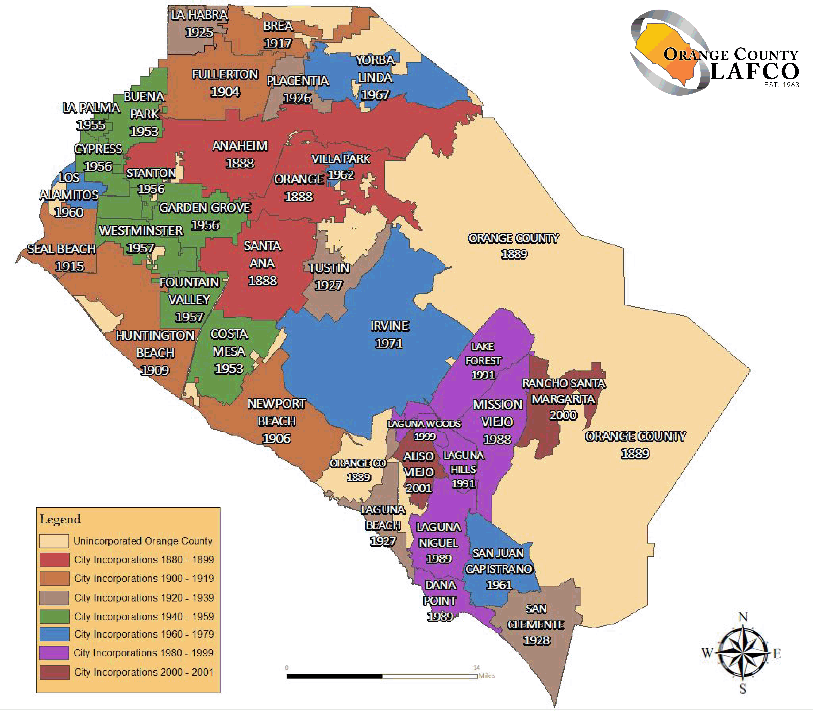 File:OrangeCountyCA Map.gif |  Orange County City Menu |  Orange County and Communities |  map of Orange County, |  Map of Orange County Beaches |
Orange County is where the Great Valley of the Appalachians finally opens up and ends. The western corner is set off by the Shawangunk Ridge. The area along the Rockland County border (within Harriman and Bear Mountain state parks) and south of Newburgh is part of the Hudson Highlands. The land in between is the valley of the Wallkill River. In the southern portion of the county the Wallkill valley expands into a wide glacial lake bed known as the Black Dirt Region for its fertility.
 Orange County California Map |  South Orange County | 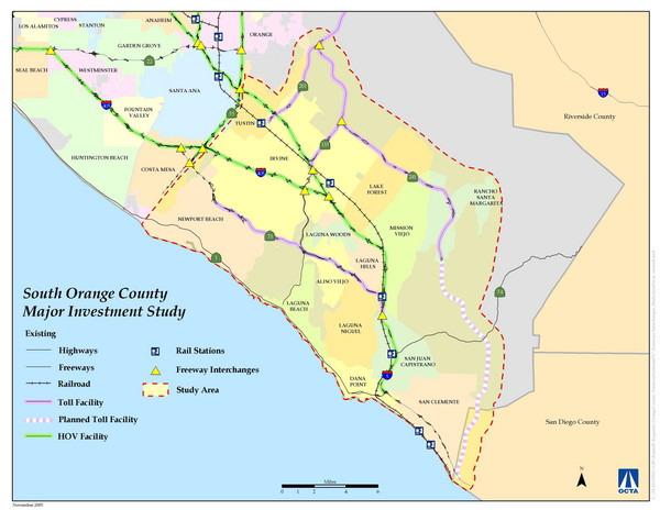 Fullsize Orange County Map |  Historic Photos and Maps of | 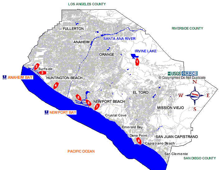 Clickable Orange County Map to |
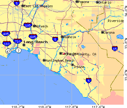 Orange County, CA map |  Map of Orange County, | 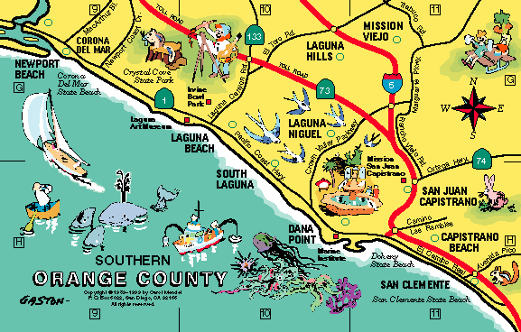 map of southern Orange county |  [Orange County Map] |  Orange County Map |

No comments:
Post a Comment